
Reading is a town built on rivers, but which has a strangely ambiguous relationship with them. In the past, they have fed local industries and powered local mills, today they offer endless leisure opportunities, but today Reading's waterways lie largely empty with little boating and boarded up or closed pubs and restaurants on their banks.
So why are our waterways and watersides practically barren ? And why has the council admitted to being unable to do anything about this ?
Looking Back
The story of Reading’s rivers begins long before it was a town. The Kennet and the Thames, both alluvial and gritty green brown, are fed by ancient clear chalk streams from the Chilterns, the Berkshire Downs and Wiltshire plains. They have been shaping this landscape since the last Ice Age when their current courses were laid as the glaciers retreated.
Archaeological finds near the riverbanks suggest that Neolithic peoples were already drawn to this fertile floodplain, their flint tools and burial sites evidence of early settlement. But it was the Romans who first exploited the river's commercial potential. Calleva Atrebatum (Silchester), just a short journey south, was linked to the Thames valley by trackways and the Kennet. The river enabled trade, transporting everything from iron tools to wine amphorae to and from the main port at Londinium.
However a problem then remains today - the rivers form flood plains and marshlands that need taming and management.
By the time Reading grew into a Saxon settlement the rivers had established themselves as economic highways. The Thames connected Reading to London and Oxford, while the Kennet provided passage deep into the rural heartlands and its mills and wool.
In 1121, Reading Abbey was founded by King Henry I. The monks, pragmatic and ambitious, recognised the power of the water. They constructed the Holy Brook, a man-made channel of the Kennet, to supply the abbey with fresh water and to power their mills. Today, the Holy Brook still flows, partially hidden beneath Reading’s streets, surfacing occasionally behind the King's Road - a secret passageway through time.
Bread, Beer, and Bricks
Through the Middle Ages and into the Industrial Revolution, the rivers underpinned Reading’s prosperity. Its mills ground flour for bread, its water brewed beer, and its wharves bustled with barges laden with bricks from local kilns and agricultural produce from the Berkshire countryside.
By the 18th century, the Kennet Navigation transformed the river into a working canal, linking Reading to Newbury and ultimately to Bristol. The subsequent arrival of the Kennet and Avon Canal created an unbroken inland waterway between London and Bristol and was the motorway of its day, until disrupted by the onset of the railways.
During the Victorian era, the town became a quintessential ‘railway town’, but the rivers remained vital. Huntley & Palmers, the biscuit giant that helped Reading earn its moniker as the ‘biscuit town’, used the waterways to ship biscuits globally (water is smoother than railways and prevented breakages). Simultaneously, the riverbanks saw malting houses, iron foundries, and print works flourish. There was even a yard where Gypsy caravans were made opposite the Queen's Road car park where The Outback pub now stands.
As with many industrial hubs, Reading’s rivers became polluted and silted. The very lifeblood that had sustained the town began to choke on its success. By the mid-20th century, waters that had once shimmered with salmon became sluggish and tainted.
Gradually, however, they were used for leisure. Older residents still remember how the area at Kennet Mouth in front of The Dreadnought pub was Reading's beach, and a lido was built for the lady workers at Huntley & Palmer's by Caversham Lock (the men had to make do with the river itself). Many rowing clubs existed on the stretch of river. Fishing was a popular passtime, even if the salmon no longer migrated. The transformation of the industrial waterways into the leisure age had begun.
A Waterside Renaissance
The Oracle Shopping Centre, opened in 1999 on the site of a car park and bus station, marked the beginning of Reading’s waterside renaissance. Built on the site of an 18th-century iron foundry, it reimagined the Kennet’s edge as a place of leisure—restaurants, cafés, and boutiques lining the revitalised banks. However, the opportunity to widen the canal at this point and provide moorings was not taken, and the river now regularly floods the adjacent walkways.
Other riverside areas, once dominated by warehouses and derelict mills, were ripe for the transformation that continues today with development such as Huntley Wharf and the new Reading Riverworks development on Vastern Road. Living by water commands a premium.
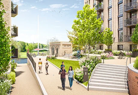
The new development at Reading Riverside
Gradually, better sanitation and conservation projects helped restore biodiversity to the Kennet and Thames. Otters, long absent due to pollution, began to return. Kingfishers once again flashed beneath the willows. Anglers started spotting barbel, dace, and even elusive salmon making their way upstream, even if the work to clean up the rivers is far from complete thanks largely to the pumping of large quantities of effluent into the waterways by Thames Water and the runoff from industrial farming upstream of the town.
Down the years, Reading’s rivers have inspired culture too—from the paintings of J.M.W. Turner to the writings of Jerome K. Jerome, who famously passed through in his comedic travelogue Three Men in a Boat.
So why is so little use made of these lovely waterways ?
Opening Up The Waterways
If you go upriver to Benson or down the river to Henley on most weekends you will find everything from weekend motorcruisers to flotillas of paddleboaters with many waterside pubs and restaurants heaving on the waterfront.
So why are the waterways in Reading seem so barren by comparison ?
The Council apparently started to look into this last year with other involved agencies such as the Canal & Rivers Trust and the Environment Agency and quickly came to the conclusion that the river and canalsides were not 'safe' enough to invest in and vowed to undertake this work before looking at further opportunities.
It seems that there has been little progress since then due to inter-agency issues and in the meantime more closures have been seen. A few boats on the Kennetmouth and elsewhere seem to be holding back any serious investment in waterfront facilities, whilst more and more privately run destinations are shutting down, hampered not only by the lack of local concern, but also the wider woes betiding the hospitality industry
Along the Thames, 'The Island' has long been shut, as has the Dreadnought by Kennetmouth (it is currently up for sale). On the Kennet the Jolly Angler, Bel & Dragon / Narrowboat, Ship (again long closed) and Loch Fyne have closed and the redevelopment of The Oracle into housing threatens more of the restaurants in that part of town where some units have been empty for some time. Units at Huntley Wharf remain empty, as does the basement of the Verto building and the old Mexican restaurant opposite.
There are moorings aplenty, but the confusing state of paying for these bearths means that almost all are empty, with a small, merry band of renegade waterbourne dwellers congeregated around Kennetmouth and the Thames, much to the ire of the council and apparently causing all this neglect.
The irony is, of course, that the more people and activity there is, the safer people feel, so we can all hope that the council and various agencies involved will see a way through the current impasse and encourage greater and better use of the rivers that define our town.
See interview below with Thames Ward councillor, Adele Barnett-Ward.


Comments
No comments yet. Be the first to share your thoughts.
Join the conversation
Subscribe to inReading to leave a comment.